×

Cholera Public Health Alert
Blantyre City Council urges all residents to follow cholera prevention guidelines and report suspected cases immediately to the nearest health facility.
Download Flyer
Blantyre City Council urges all residents to follow cholera prevention guidelines and report suspected cases immediately to the nearest health facility.
Download FlyerBlantyre City Council
Manja Road Rehabilitation
Upgrading of Roads at Manja to Asphalt Surface – 1.3km .
| Name | Status | Duration |
|---|---|---|
| Manja to Asphalt Road | 85% | 4 Months |
| Green Malata to Bangwe Living Waters Church Road | 98% | 9 Months |
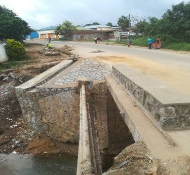
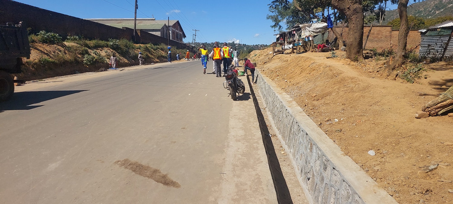
Road Drainage Rehabilitation Project
Rehabilitation of Damaged Culverts at Chilobwe, Chimwankhunda and Zingwangwa
| Market | Status | Duration |
|---|---|---|
| Rehabilitation of Damaged Culverts at Chilobwe, Chimwankhunda and Zingwangwa | 100 | 6 Months |
| Rehabilitation Works at Area 5, along Mthawira Turn Off and Nangafuwe Bridge in Machinjiri | 100% | 6 Months |
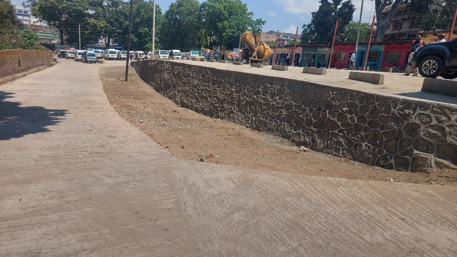
Mibawa Terminal Rehabilitation Project
Rehabilitation of Mibawa Minibus Terminal
| Name | Status | Duration |
|---|---|---|
| Rehabilitation of Mibawa Minibus Terminal | 100% | 90 Days |
| Rehabilitation Works at Blantyre Market Bridge | 100% | 6 Months |
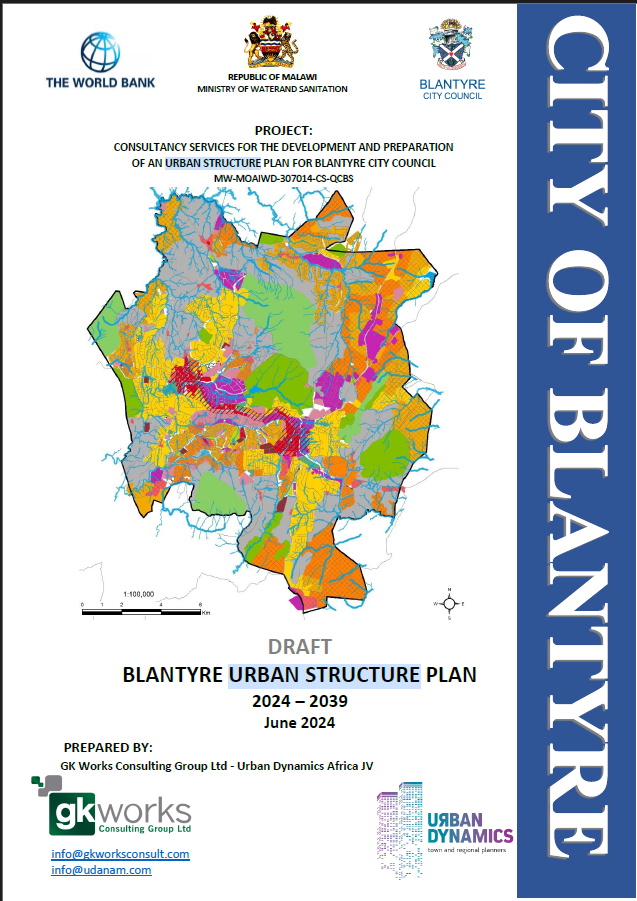
Blantyre Urban Structure Plan (2024–2039)
Blantyre City Council, with funding from the World Bank, developed a comprehensive Urban Structure Plan to guide development for the next 15 years. The plan aligns with the Physical Planning Act (2016, amended 2022) and addresses rapid urbanisation, infrastructure challenges, and resilience building. It outlines planning policies, future land uses, transportation networks, and guides land use decisions to ensure orderly city development. The project was completed in 2024 and is now under implementation.

Malawi National Addressing System
The Malawi Government through MACRA is implementing the Malawi National Addressing System to assign physical addresses to properties nationwide. The project has achieved major milestones including development of national postcodes and naming of over 2,000 streets in Blantyre City, covering 27 neighbourhoods such as Namiwawa, Chinyonga, Makata Industrial Area, Chitawira, Sunnyside, Njamba, Naperi and others. Residents are encouraged to collect their street addresses from Civic Offices under the Directorate of Town Planning and Estates Services.

Increased Land Productivity Project
The ILP is a reform initiative aimed at strengthening land administration, improving land governance, and increasing land-based revenue. Supported by MCA-Malawi II and funded by the World Bank, the project focuses on modernising property mapping, valuation, regulatory reforms, digitisation of land records, and automation of council land services. The project aims to enhance efficiency, transparency, and responsiveness in land management systems.

Multi-Hazard Risk & Flood Management Plan
Supported by the World Bank, the Multi-Hazard Risk Management Strategy assessed risks from floods, landslides, earthquakes, and droughts. Hazard maps, risk tools, and integrated flood management plans were developed to help the Council design resilient drainage and infrastructure systems. The project included modelling of 1:50 flood lines, identification of high-risk zones, and capacity building for decision-makers. Completed in 2024, the project ensures hazard-sensitive planning in the city.

Slum Upgrading Initiatives
Blantyre City Council undertakes slum upgrading to improve informal settlements through better access roads, sanitation, stormwater drainage, waste management, street lighting, and secure land tenure. Communities such as Ndirande, Chilobwe, and Ntopwa benefit from infrastructure improvements, plot surveying, and participatory planning. The initiatives focus on resilience, safety, legal recognition, and inclusive urban development.